A national dataset of annual urban extent (1985-2015)
- GEOG HKU

- Jul 22, 2023
- 1 min read
Updated: Apr 30, 2024
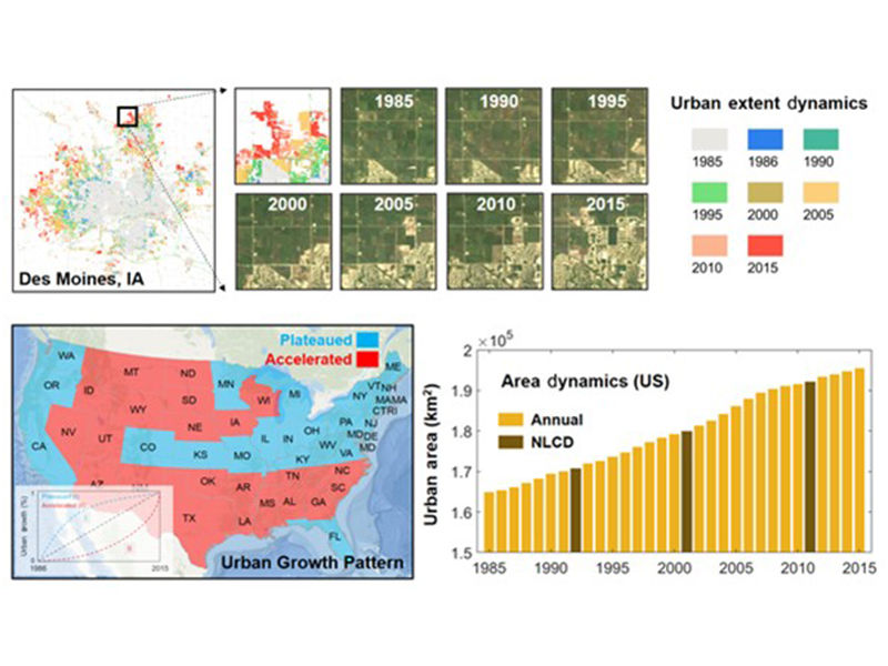
Li, X., Y. Zhou*, Z. Zhu & W. Cao (2020) A national dataset of 30m annual urban extent dynamics (1985–2015) in the conterminous United States. Earth Syst. Sci. Data, 12, 357-371.
Li, X., Y. Zhou*, Z. Zhu, L. Liang, B. Yu, and W. Cao (2018), Mapping annual urban dynamics (1985–2015) using time series of Landsat data. Remote Sensing of Environment 216: 674-683.
We mapped urban dynamics from Landsat time series data using the Google Earth Engine (GEE) platform and developed a national dataset of annual urban extent (1985–2015) at a fine spatial resolution (30 m) in the conterminous United States (US).
Spatial Resolution: 30m;
Temporal Resolution: Annual;
Temporal Coverage: 1985-2015


Comments